PAS128 Utility Surveys

Our experienced surveyors undertake underground utilities mapping in accordance with PAS 128

Get a Quote for Your Utility Survey

We've completed thousands of ground investigations, contaminated land assessments and geotechnical surveys across the UK, for national house builders, private developers, planning consultants, and self-builders. When you get in touch, you'll speak directly with an experienced specialist, not a sales team.

  • Response within one working day
  • 20+ expert staff, mobilised rapidly
  • In-house UKAS-accredited laboratory
  • CHAS and AGS-accredited projects.
Not sure what you need? Tell us about your site, and we'll point you in the right direction, no obligation.

    PAS128 Utility Surveys

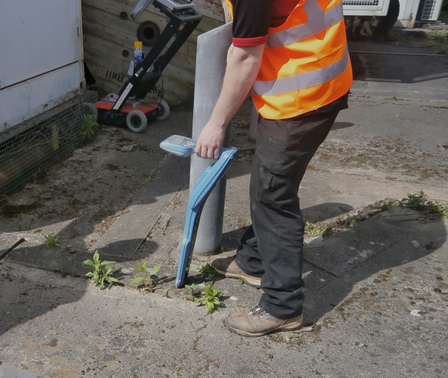
    We can detect and map metal pipes, plastic pipes, electricity cables, drainage systems, telecoms, traffic signalling, and fibre optic cables, using a range of techniques including:

  • CAT scanning (specifically Radio Frequency/Electromagnetic Location, or EML);
  • Ground Penetrating Radar (GPR) with multi-frequency (200 to 600 MHz) and multi-polarization antennas;
  • Visual inspection, cover lifting, sounding, and consulting statutory records.

    Alongside our topographic survey expertise, we are capable of creating a comprehensive model of above and below-ground details.

    Applications include site-wide surveys or clearance at specific excavation locations.

    The survey work is conducted in accordance with the best accepted current practice and complies with the requirements of PAS 128:2014 – Specification for underground utility detection, verification, and location.
  • What Do We Do?

    We also specialise in challenging sites, such as basements and difficult access areas, agricultural land, private residential properties, operational industrial premises and public spaces.

    Our services include:

    Get In Touch

    Need Expert Ground Investigations,
    Laboratory Assessments or Consultancy for Your Project?

    In addition, we also undertake a variety of specialised investigations relevant to geotechnical and contaminated land assessments.

    Contaminated Land Assessements

    Land Science can assist with contaminated land assessments as part of a planning application or any other purpose prior or during house building, commercial development or creation of new infrastructure.

    Land assessments are often required to assess soil contamination or groundwater pollution issues amongst a host of other potential problems. We assist at all phases of the assessment process with comprehensive desk studies, site investigations, contaminated land remediation and validation and post remediation monitoring.

    Read More

    Geotechnical Support

    Land science provides geotechnical investigations which will help you to make informed decisions about the design of pavements, foundations and drainage on your project. Our in-house geotechnical laboratory testing capability enables us to undertake a range of sample analysis in-house.

    Where more specialised geotechnical testing is required, we have a range of trusted preferred partners that we call upon on a regular basis.

    Read More

    Safety and Accreditations

    The safety of our employees, sub-contractors and other personal, members of the public, and the wider environment is paramount to us. All our staff receive comprehensive safety training, with each project being managed by a designated Site Safety Supervisor. Our staff are CSCS card holders, and our drillers also hold NVQ qualifications. The company has detailed Safety, Health and Environment procedures, and is CHAS accredited.

    Latest Projects

    Geo-environmental

    Whitchurch, Shropshire

    Portslade
    Commercial & Industrial

    Hove Enterprise Centre, Portslade

    Request a Call Back

    Feel free to contact us directly. Alternatively, if you would like us to contact you, please fill out the form with your details and we will get in touch.